West End Hub
Transportation
*This website is still a work in progress!
West End Context
West End Hub Big Moves
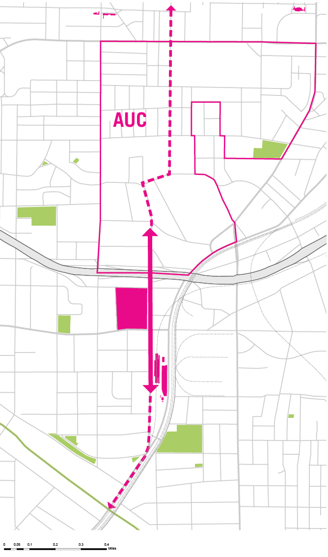
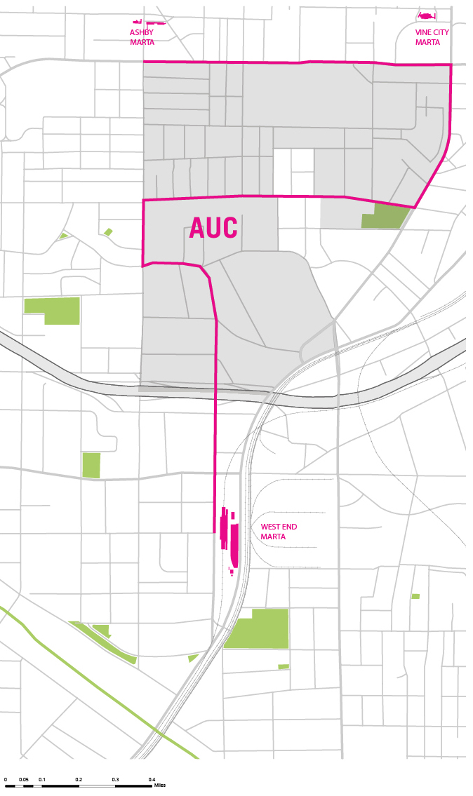
Transportation infrastructure, such as Interstate 20, north-south rail lines, and the discontinuous Northside Drive, has limited the amount of external connections to the West End area, isolating West End from Downtown and its surrounding communities. The best opportunity for re-establishing connectivity to the communities surrounding West End is with its neighbor to the north, the Atlanta University Center (AUC). The connectivity between the AUC and the West End community has been fractured by Interstate 20. The area of AUC and West End was a contiguous community until the construction of the interstate. In order to capitalize on the commercial and economic opportunities of West End, the connectivity between the AUC and West End must be reestablished and strengthened. The following is a brief 'SWOT' analysis of current transportation infrastructure, identifying the strengths, weaknesses, opportunities, and threats to the economic well-being of the West End community.
SWOT
- +The neighborhood is within close proximity to several strong commercial bases
- +AUC has access to MARTA bus and rail service at West End station through a shuttle service
- +Bicycle and pedestrian facilities are expected to improve after the Southwest Trail of the Atlanta BeltLine is built just south of West End
- +Streetscape improvements on RDA commercial corridor are already underway
- +Connectivity to AUC, Downtown, and surrounding neighborhoods is constrained by I-20, commercial and passenger rail, and the discontinuity of Northside Drive
- +Current configuration of I-20 ramping system at Lee Street discourages bicycle and pedestrian traffic in the Lee Street Corridor
- +Lack of trees around commercial core promotes urban heat island effect, making pedestrian/bicycle travel unpleasant
- +Current shuttle from AUC lacks visibility and runs on an infrequent schedule
- +Lee Street corridor lacks a cohesive commercial environment
- +Current Lee Street bridge over I-20 is very wide, with more capacity for vehicular traffic than necessary; Space is available for pedestrian/bicycle improvements
- +Realignment of Northside Drive into West Whitehall Street may ease need for capacity in vehicular north-south traffic in Lee Street corridor
- +Planned bicycle facilities on RDA, Peters Street, Whitehall Street, Joseph E Lowery Boulevard and Lee Street south of RDA will supply West End with a network for transportation alternatives that could link to the AUC
- +Planning for the extension of the Atlanta Streetcar is under way and is considering how to provide connections to both the AUC and West End
- +The proposed West End Commercial Improvement District could provide the West End business community with a means to increase the appeal of the commercial core and improve connectivity to surrounding areas
- +The AUC's willingness to embrace the West End as an extension of their campus is not certain and may be overshadowed by an interest in connecting with communities north and east of campus
- +Funding for improvements to the Atlanta BeltLine, area bicycle infrastructure, and Atlanta Streetcar has not been fully identified and may result in substantial delay in their implementation
- +If the proposed West End Commercial Improvement District is unable to gain enough members, the West End business community will have limited capacity to direct and fund improvements
Objectives of Solutions
The following proposals are put forth to increase the overall pedestrian activity and access to the West End commercial core. Through initiatives that enhance the walkability, safety, access, and aesthetics of the connections between West End and the AUC, additional opportunities would be created for increased commercial activity and investment. This potential activity and investment could lead to improved development patterns that are more supportive of the existing rail station and the attractiveness of the community for investment. p>
AUC Shuttle
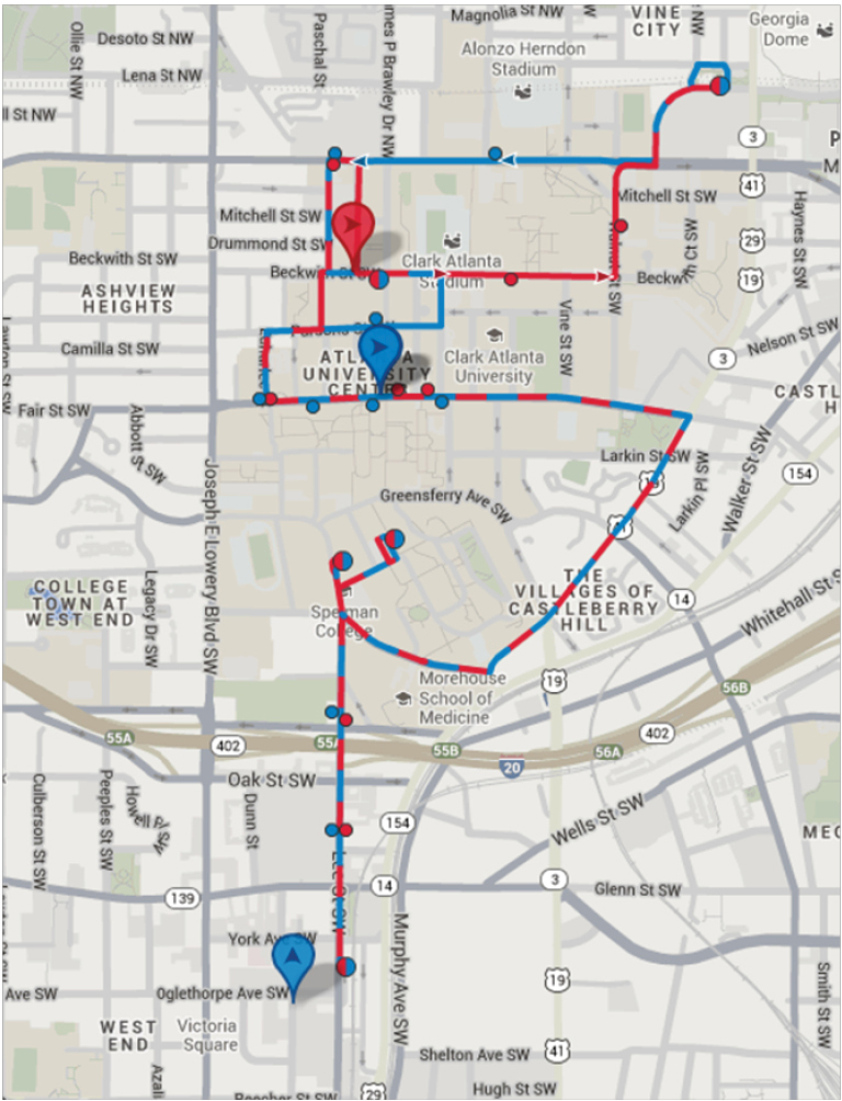
As an initial step, a more visible and improved shuttle with a frequent service and a clear route would create connections between the AUC, West End, and three MARTA stations. The AUC currently provides a shuttle daytime shuttle but lacks a single fixed route, consistent schedule, and sufficient evening and weekend hours of operation. The inclusion of one set route and a frequent-service shuttle, including during nights and weekends, will provide a reliable connection between the communities and increase the overall potential for commercial activity in the West End. This would also create opportunities to engage the AUC and West End communities with one another and to mitigate some of the isolation caused by I-20.
Current AUC Shuttle Route
West End Commercial District Streetscape
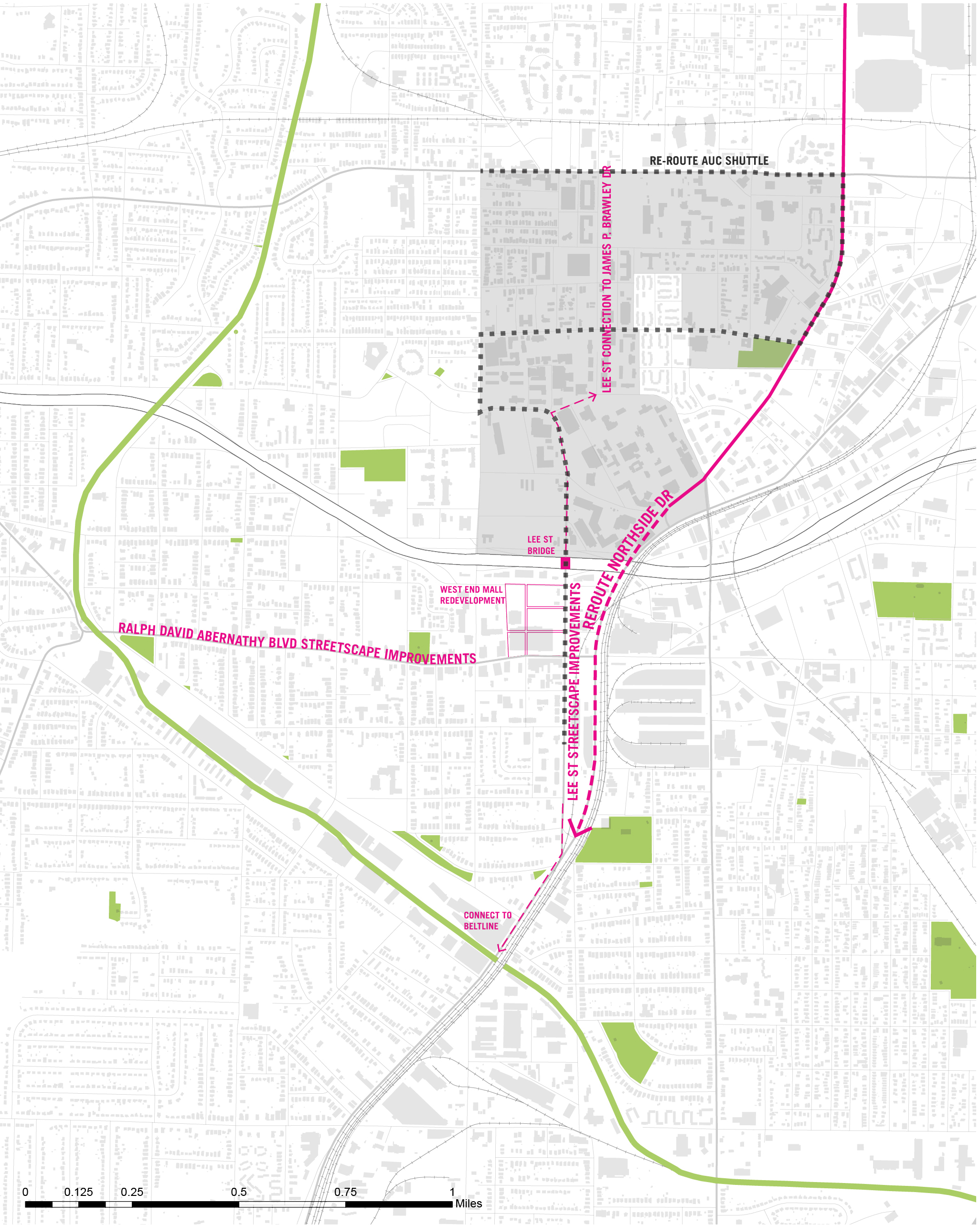
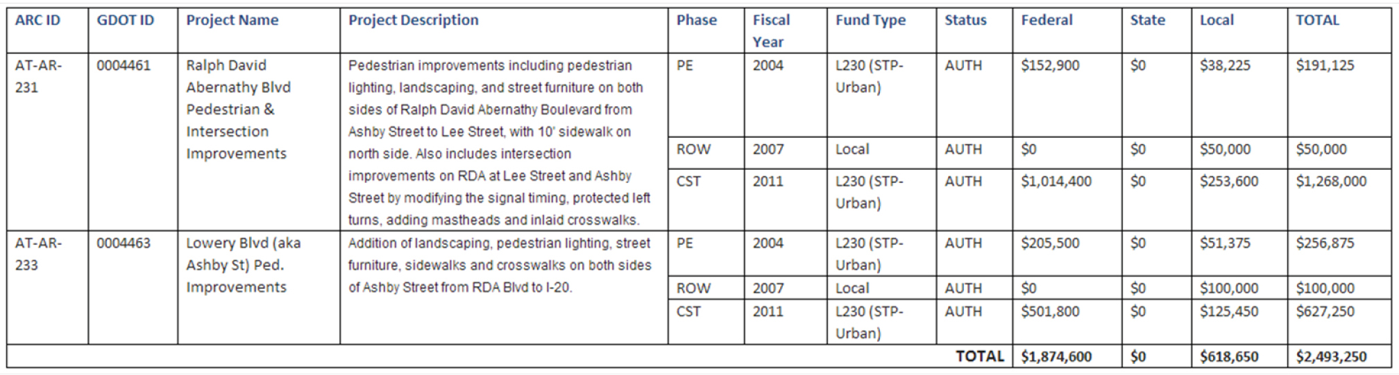
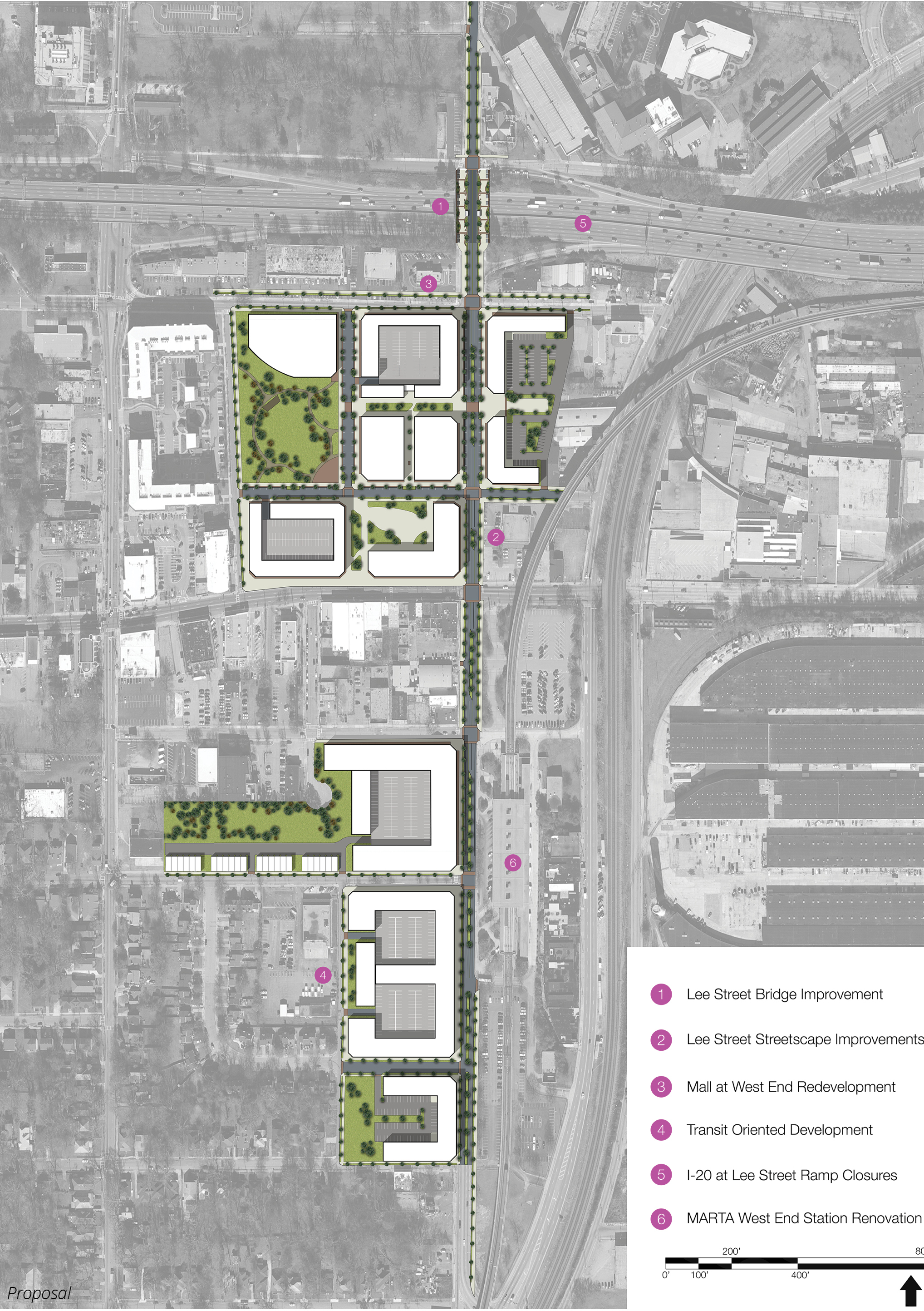
The City of Atlanta's Department of Public Works has three West End Livable Centers Initiative projects funded by federal Surface Transportation Program funds and local funds. These projects are all streetscape improvements which aim to increase pedestrian connectivity in the area. The first project consists of pedestrian and intersection improvements to Ralph David Abernathy (RDA) Boulevard from Lowery Boulevard to Lee Street. Construction began fall 2013 and is scheduled to be completed spring 2014. The second project consists of pedestrian improvements to Lowery Boulevard from RDA to I-20. Finally, the third project consists of pedestrian improvements near Harris Homes along Lowery Boulevard from I-20 to Sells Avenue.
It is recommended that pedestrian, intersection, and streetscape improvements also be constructed on Ralph David Abernathy Blvd past Lowery Boulevard, on Oak Street (between Lowery Blvd. and Lee Street), and on Lee Street from the AUC to the West End MARTA station. These infrastructure improvements would support the mission of increased connectivity to surrounding neighborhoods by providing a more walkable connection to the AUC, the Metropolitan Lofts, and other communities.
CRDA Street Improvements: from email sent by Amy Goodwin of ARC to Charlene Mingus
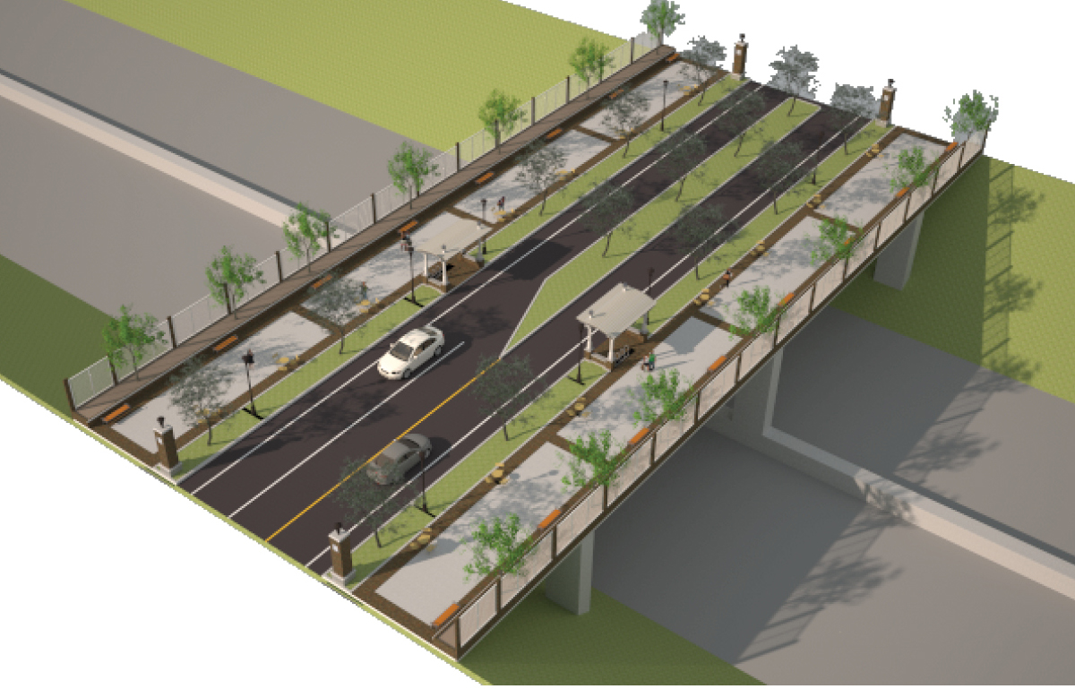
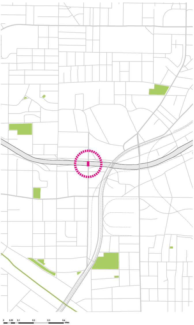
Lee Street Bridge
In order to capitalize on the potential of the West End MARTA station, and to evolve the area into a walkable and more transit-oriented community, improving the pedestrian infrastructure network and streetscape plays an essential role. Lee Street Bridge, spanning over Interstate 20, represents the greatest opportunity to establish a physical connection between the AUC and West End, while also increasing walkability and bikeability to the West End commercial district. Centered between the two communities, the Lee Street Bridge represents an opportunity to serve as a dually supported connection and node. Lee Street Bridge could also serve as a node and a place for activity and gathering while connecting the two communities. For example, the repurposed bridge provides an opportunity to host AUC and community organization events (e.g., local small fresh food and retail vendors) as well as serving as an informal destination for social gatherings For comparison and validation, a similar idea has already been implemented at the 5th Street bridge, connecting Georgia Tech to Midtown.
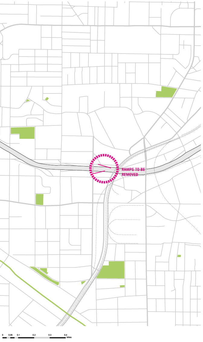
Closing of the Interstate 20 Exit and Entrance Ramps
To support the Lee Street Bridge as a means of improving the walkability of the entire Lee Street corridor, it is recommended that the ramps immediately north and south of the bridge that provide access to Interstate 20 be closed. By doing so, a continuous pedestrian-friendly corridor, uninterrupted by interstate access traffic, is created, supporting a pleasant and continuous pedestrian path. With existing entrance and exit ramps less than a quarter mile west, removal of the I-20 access ramps at Lee Street should not inhibit access to both West End and the AUC. The ramps at the Lee Street Bridge represent an unnecessary impediment to the connectivity and aesthetics of the corridor and connectivity of the Lee Street Bridge. In addition, because of their close proximity to other interstate ramps and the weaving movements they induce, reworking these ramps should improve safety and operation of I-20. Furthermore, the closing of the ramps should reduce the overall traffic on Lee Street and many of its intersecting streets that reduce the walkability of the Lee Street corridor.
Financing Solutions
Funding for the AUC shuttle could be a partnership between the AUC, MARTA, and the proposed West End CID. All three have a vested interest, the West End with increased commercial activity, MARTA to promote cooperative approaches to boosting ridership, and the AUC as an extension to their campus. Partnering would make the commitment more feasible and less expensive for each. The proposed pedestrian and bicycle improvements, which should also stimulate commercial activity, may have the potential for funding from the BeltLine TAD.
Funding for the bridge would likely need to come from multiple sources. While opportunities for fundraising activities between West End and the AUC could be available, support would also need to come from the Georgia Department of Transportation (GDOT) and the City of Atlanta, with funding package similar to that of the Fifth Street Bridge. Funding for the closing of the Interstate 20 ramps would likely need to originate from the GDOT as well. An updated Livable Centers Initiative plan could lead to a capital grant from ARC as part of match funding.
Northside Drive Connection
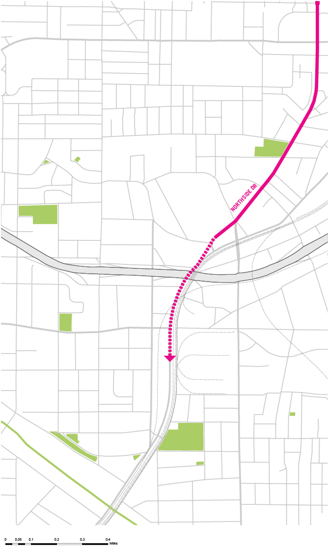
A studio completed in the spring of 2013 dealt specifically with changes to the Northside Drive corridor. Work for this project was essentially broken up into sections of the corridor itself. As such, the southern terminus of Northside Drive was one of the sections of the project; this is the part of the project the planning effort for the West End is most concerned with.
The project found that the southern terminus of Northside Drive, and the area near it around I-20, is 'characterized by a confusion of land use, transportation infrastructure, deterioration, disconnectedness, and environmental complications.' Unclear routes to major destinations, confusing intersections, and different types of infrastructure at different grades (roads and rails) plague this area. At the same time, the area is thought to have potential, being bordered by the redeveloped residential area of Castleberry Hill, the Atlanta University Center, and the core of West End, which includes the West End MARTA rail station.
A realignment of Northside Drive in this area was identified by the studio as the single largest and most cost- and time-effective improvement that could be made to reinvigorate the area and create positive effects for the adjoining areas. Specifically, the studio recommended Northside Drive be shifted to follow Peters Street and West Whitehall Street south from downtown (presently, one must turn onto Chapel Street and then Peters, which becomes Whitehall). This realignment would create better connectivity between the Northside Drive corridor (and downtown more generally) and I-20 and the West End. It would provide a seamless connection with Ralph David Abernathy Blvd. and the West End MARTA station. In doing so, it would also reduce confusion on the part of travelers between the two areas, possibly encouraging more interaction between the two areas.
The need for this realignment of Northside Drive is reinforced by the planning effort for West End. The proposed new Northside Drive alignment is therefore considered in the transportation plan for the West End (including realignment of the I-20 on- and off-ramps) and in land use recommendations. encouraging more interaction between the two areas.
Transportation Vision
1. AUC Linkage - Lee St. Bridge Over I-20
2. AUC Linkage - Lee Street Pedestrian Corridor Improvements and Connection to Brawley and Beltline
3. AUC Linkage - Improve Shuttle From AUC to West End
4. Downtown Linkage - Northside Drive Connection to West End
5. I-20 Linkage - Ramping System Improvements to Alter the Traffic Flow to Suit the Proposed Pedestrian Corridor on Lee St.
Proposal
Lee St Street Current Situation
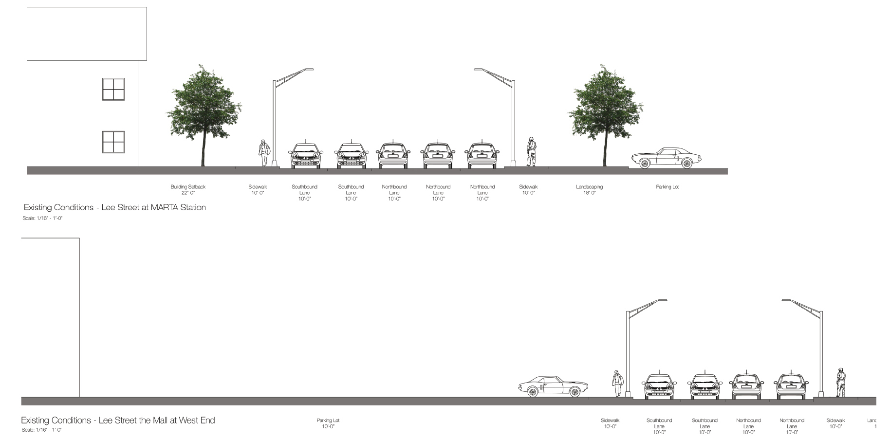
Lee St Street Improvements
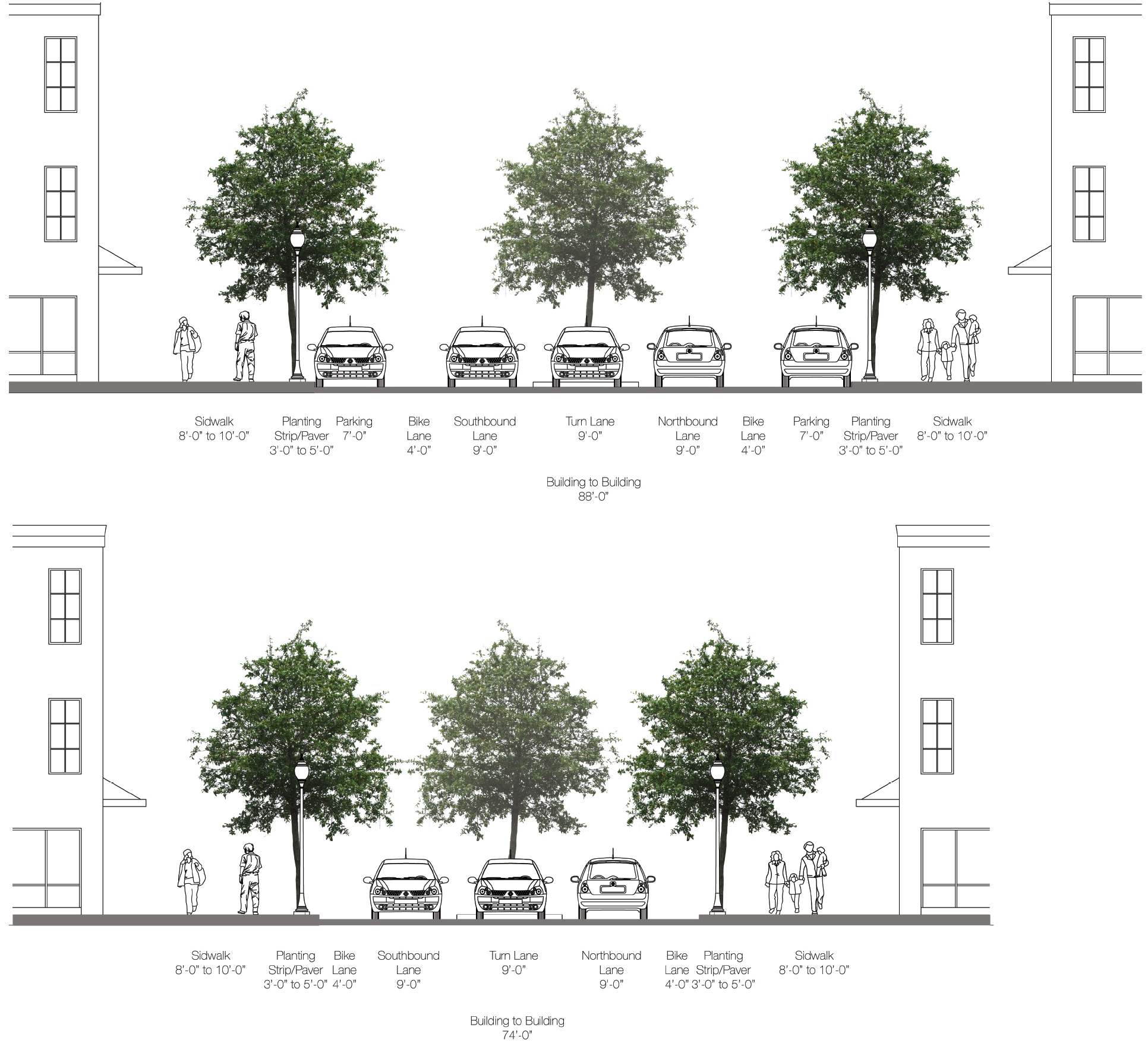
Lee St Street Bridge Alternatives - Sections
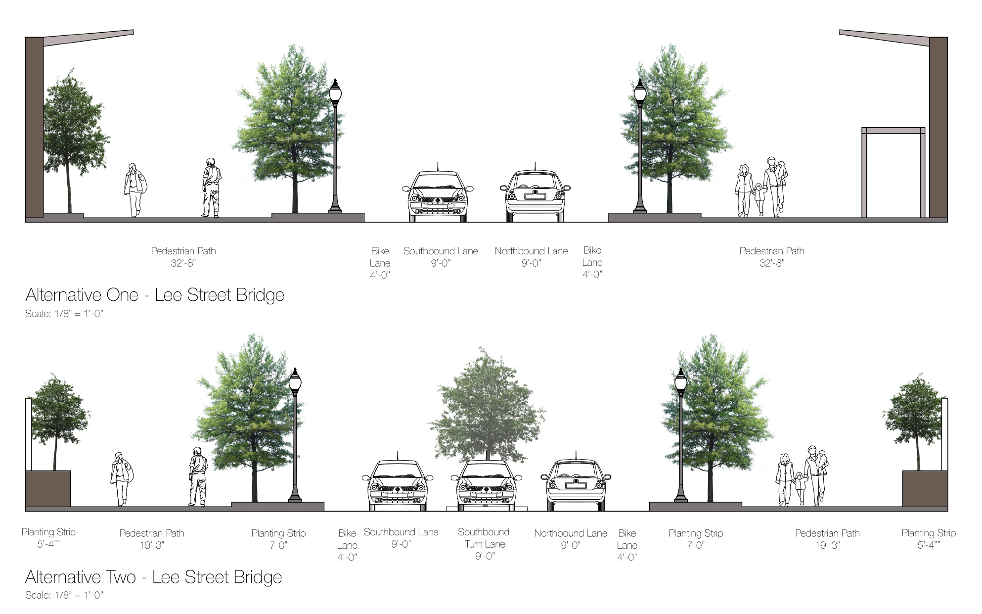
Alternative 1- Lee St Bridge
Alternative 2- Lee St Bridge